114km / 71mi ~ 5-7 days ~ Waypoints 19 to 24
Singing Sands and Tasty Treats
SECTION 20: Mt. Stewart to St. Peter’s – 27km / 16.8mi
WAYPOINT 19
Start your walk in Mount Stewart, where you will hike along one of the most scenic sections of the Confederation Trail. The first 7.5 km includes a 40 metre climb that is so gradual you will hardly notice it. Throughout this stunning segment of the walk, you will pass old bridges and vast fields. Be sure to stop in the town of Morell, where you can enjoy a delicious lunch at the Holy Cow, PEI OH MY Takeout or The Seafood Shack.

After lunch, you will start the spectacular walk to St. Peter’s where you will see stunning views of St. Peter’s Bay. You won’t be able to miss the hundreds of mussel buoys in the bay and be sure to keep an eye out for two gorgeous white clapboard churches along the way. St. Peter’s may seem small, but it’s got a lot to offer! There is the opportunity to browse some local shops at St. Peter’s Landing. Grab some delicious food at Black & White Café Bistro and Rick’s Fish and Chips.
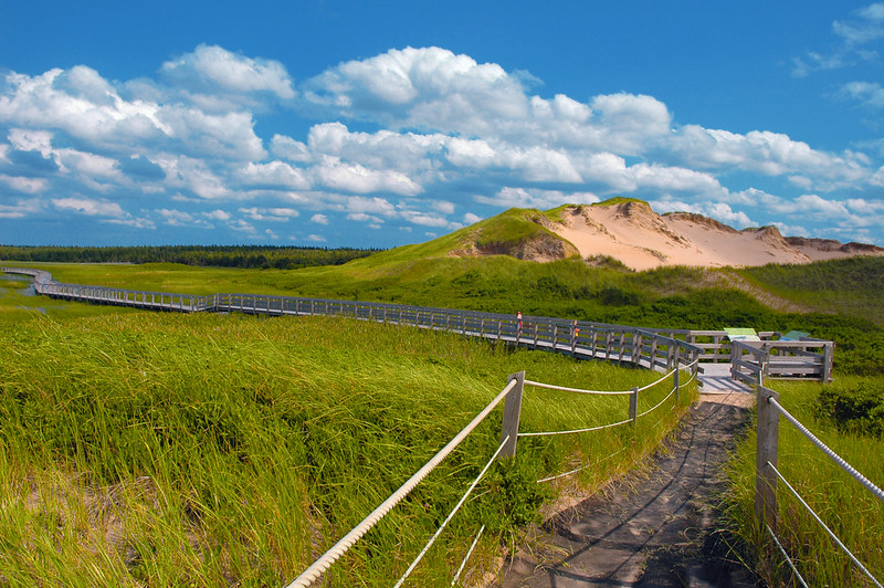
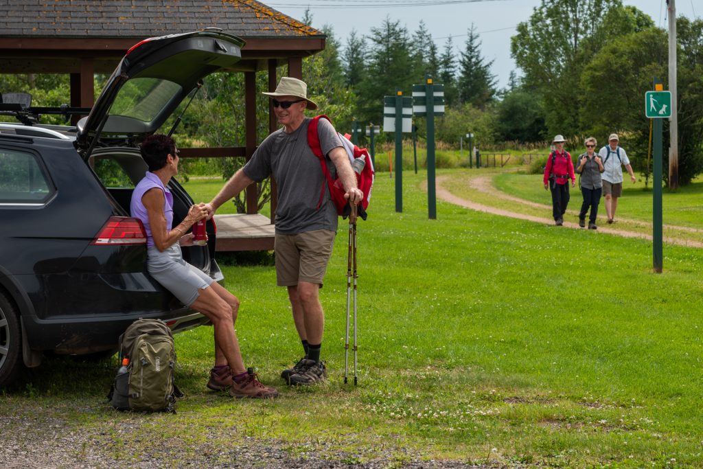
If you have time to linger here, stop at Confederation Trail Bike Rental Adventures, rent a bike and take a side trip to Greenwich in the PEI National Park (map) and visit the Greenwich Interpretation Centre which features over 20 exhibits to help you learn and appreciate the amazing natural and cultural history of this special place. Walk the floating boardwalk where you’ll find a secluded beach with soft sand and comfortable picnic areas, as well as supervised swimming waiting for you at the end of it.
Confederation Trail Bike Rental Adventures (near Waypoint 20)

WAYPOINT 20
If the St. Peter’s area is your resting spot for the night. St. Peter’s Bay is the new home of the Canadian Centre for Climate Change and Adaptation. The facility will house research centres, including the internationally recognized UPEI Climate Research Lab. It will also serve as a living laboratory that allows for unlimited access to nearby wetlands, forests and coastal habitats directly affected by climate change.
Points East Coastal Inn (just before Waypoint 20)
Gateway to Greenwich Suites (at Waypoint 20)
Section 21: St. Peter’s to New Zealand – 23km / 14.3mi
Onward to a peaceful walk through a picturesque forested section of the Confederation Trail. Enjoy a picnic lunch beside one of the many beautiful lakes you will see as you walk to New Zealand.
At the end of Section 21, stay nearby at the Johnson Shore Inn. They will come pick you up and drop you off the next day. Stay multiple nights because they offer transportation!
Johnson Shore Inn
– Transportation to Waypoints: 20, 21, 22, 23, 24

Section 22: New Zealand to Elmira – 21km / 13mi
WAYPOINT 22
Your walk will continue to take you along the Confederation Trail through PEI’s only bird sanctuary. The stunning nature on this portion of the trail includes spiritual spring that you can’t miss. If you are travelling in the summer months, be sure to check out the Elmira Train Museum.
Just past the end of Section 22, stay nearby at the North Lake Beach Motel.
Johnson Shore Inn
– Transportation to Waypoints: 20, 21, 22, 23, 24
Section 23: Elmira to Bothwell – 22km / 13.7mi
Leaving Elmira, you can take a road walk past North Lake, or you can slip down to East Point. There you will see an Island phenomenon, the meeting of the ocean tides at East Point which is spectacular to see before taking a road walk to Bothwell.
Johnson Shore Inn
– Transportation to Waypoints: 20, 21, 22, 23, 24
Section 24: Bothwell to Souris – 21km / 13mi
WAYPOINT 23
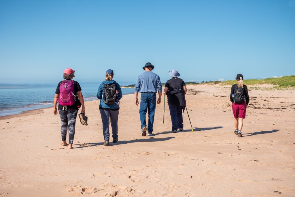
From Bothwell, head to Elliot’s General Store and take advantage of the option to walk along the beach. Turn left onto Mossey Road and head down to Mossey Beach and walk to Basin Head Beach, home of the world-famous singing sands, it’s truly a sight to see and hear! Basin Head has been on the top of the Best Beaches in Canada list on various travel and tourism websites. When you see it, you’ll know why!

After the beach, plan to stop at the Basin Head Fisheries Museum to learn more about the story of PEI’s historic inshore fishery with their displays and exhibits that will take you back in time. During the summer months enjoy lunch while watching brave swimmers jump off the Basin Head bridge.
Johnson Shore Inn
– Transportation to Waypoints: 20, 21, 22, 23, 24

Next, you’ll walk along some peaceful red dirt roads and quiet side streets and arrive in Souris, known as the friendly seaside town. Souris is a bustling tourist destination and has lots of options for things to do and places to stay and eat. For more information, visit the town’s website. We recommend stopping in at the Souris Beach Gateway Park. This beach is well known as a great source for discovering sea glass, clam digging and swimming. There you will find The Poke Shack with great Island tuna and seafood poke bowls.
Johnson Shore Inn
– Transportation to Waypoints: 20, 21, 22, 23, 24
This itinerary is part of the Points East Coastal Drive.
For more information on region of PEI visit their website.

